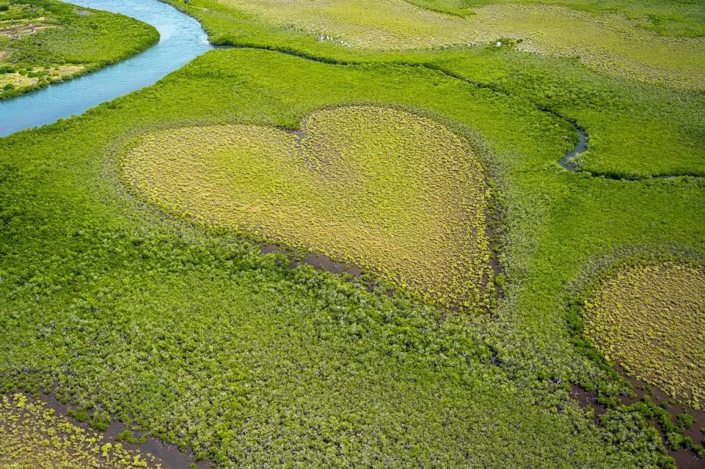
Greenmapper: A citizen-science platform for the nature places you love
Map the nature and landscapes that matter to you, and help shape how they’re protected, discussed, and funded.
What is Greenmapper?
Greenmapper is a growing citizen-science platform developed at the University of Groningen. It connects people who love specific nature areas with the organizations that protect them – building unique insights into how landscapes are valued, and giving those who care a real voice in their future.
Three ways to get involved
Love it? Map it
Mark the nature and landscape areas you care about, from local to global.
Let's talk nature
Join conversations about the places you love, with other fans and the organisations that manage them.
Fund the future
Show where you’d be willing to support nature projects, and help shape what gets funded.
Ready to start?
Find out more:
Why we built Greenmapper
We at the University of Groningen in the Netherlands have a double mission with Greenmapper.
First, we want to strengthen both science and policy with better data on the appreciation of nature and landscapes. For this we are building a crowd-sourced Greenmapper Attractive Nature Database. Our aim is to have 125.000 representative respondents from 50 countries marking nature places: at local, regional, national, and global levels to allow for serious analysis and policy support at all levels.
Second, we want to make it easy and normal for fans of areas to be reachable online for governance purposes. For this, we develop the Greenmapper Friends platform. We aim for 1 million people being reachable as an online friend of their favorite nature areas and landscapes, to digitally revolutionize nature and landscape governance.
Help us in our mission and join in! We will do the science. And together with our partners, we will work on improving the governance of nature and landscapes. Please note: Your personal data remain private with Greenmapper.
Recent projects
We are currently working on different projects together with societal organizations. One major project is the Interreg project FREIIA together with island partners in Norway, Sweden, Denmark, Netherlands and France. Another project is the ‘Innovative financial instruments for landscape governance’ project together with the National Park of Texel and Staatsbosbeheer (a.o.).
As part of the activities of the UNESCO Chair Sustainable Landscape Governance, Education and Citizen Science, we will work closely with the nearly 800 UNESCO Biosphere Reserves in 142 countries in the coming years.
Join our recent projects
Join Greenmapper as a landscape organization
Greenmapper also serves the other side of the conversation.
Landscape management organizations can use the platform to see who cares about the areas they protect, reach those people directly, open discussions, run Polis conversations, and invite support for specific projects. Most of our organisational partners come to us through research networks, projects, and conferences. If you’d like to explore how Greenmapper could work for your landscape, get in touch with our scientific founder, dr. F.J. Sijtsma.
You can register as a (group of) nature or landscape management organizations or organizations involved in the governance of landscapes.
First you mark the area(s) you own, manage or are active in as a governance organization.
Then:
→Discover how many people marked your area
→Reach out to this community of fans through the platform through various means (messages, open discussion, polis statement polls, funding requests)
→Find where your fans hold consensus opinions on a topic of your interest and where they strongly diverge via the advanced Polis statements-based discussion tool.
→Explore the funding that fans are – in general – willing to support your area with for biodiversity, landscape scenery, sustainable business or cultural activities
→Propose specific projects for them to fund
Join Greenmapper as a fan or friend of your favorite landscapes
Register as a landscape friend for one or more attractive places
→ Mark 4 attractive nature places: local, region, nation, globe
→Non-anonymous – email and address known to Greenmapper
→Others can reach you as friend of your area, but only anonymously via Greenmapper
→5-8 minutes
→Mark up to 16 places later on
If the areas that you draw on the map overlap with areas of landscape organizations you will automatically be part of a community for that area. This allows you to take part in governance activities: idea polling via Polis, joining funding requests etc.
Fans that want to be extra active in one or more of their communities can also request to become a ‘moderator’. This allows them to be more proactive in the community.
Polis: our cutting edge tool for opinion mapping
What is Polis?
Pol.is is an online tool for opinion mapping: it helps a group of people explore what they collectively think about a topic, without the usual noise of comment threads or polls. We embedded the Pol.is software in our Greenmapper platform to support landscape-oriented statements polling.
A conversation starts with a set of short statements, prepared by Greenmapper together with the landscape management organisation. Participants agree, disagree, or pass on each statement — but here’s the twist: participants can also add their own statements, which then go to the group for voting. The conversation grows from the bottom up, shaped by everyone who takes part. As more people join in, Polis reveals where opinions converge, where they diverge, and which perspectives bring different groups together.
We use Polis because landscapes matter to many people, and good decisions require more than a majority vote. Opinion mapping makes the full range of views visible, so that landscape management organisations can act with a richer understanding of the people who care about a place.
When does it happen?
Polis conversations on Greenmapper are always tied to a specific landscape and a specific moment. When a landscape management organisation starts one, the Greenmapper Friends connected to that place are invited by email to take part. Conversations open when a landscape calls for them.
Funding for loved landscapes
How does funding work on Greenmapper?
Landscapes need care, and care costs money. But money alone doesn’t tell you what people value, or why. Greenmapper explores how funding for nature can become more than a transaction — how it can also be a signal of what matters, and to whom.
A signal of willingness
As a Greenmapper Friend, you can express how you would be willing to contribute to the landscapes you care about — not with real money, but through a structured exercise that reveals your priorities. You start by naming an amount you could imagine giving each year. Then, using sliders, you divide that amount across the landscapes in your portfolio. For each landscape, you go one step further: how much would go to biodiversity, to scenic beauty, to sustainable local enterprise, to cultural life, or to something else entirely? (If your thinking stays roughly the same across places, you can copy your last division to the next landscape and adjust from there.)
The result is a kind of personal funding fingerprint — a map of willingness laid over the map of places you love. It shows not just that you care, but how you would act if you could. For landscape management organisations, these fingerprints together reveal what people most want to protect, enhance, or celebrate — insights that rarely surface in traditional funding conversations.
Concrete project requests
When a landscape management organisation has a specific need — a restoration project, a piece of land to protect, a path to maintain — they can share it through Greenmapper with the Friends connected to that place. For now, these requests gather intentions rather than actual donations. We’re in active discussions with the University of Groningen about establishing a foundation that would make real project funding possible, and the signs are encouraging that this can be realized.
Disclaimer & Privacy Policy
DISCLAIMER
We feel we should give a warning! Yes, Greenmapper is a user-friendly web app designed for the general public. Still, it remains scientific software, with very limited funding and a very small technical support team. When compared to a simple written survey, Greenmapper stands out as a visually appealing and interactive tool. When compared to big tech applications, you may still find it far less fluent and user-friendly. Bear with us and our small team. Our means are limited, but our efforts, and yours (!), are noble.
PRIVACY POLICY
Greenmapper Friends is an initiative of the University of Groningen. Greenmapper Friends stores your emailaddress in the Greenmapper Landscape Friend Registry (GLFR). No one can access this email accept the Greenmapper organisation. You can via the GLFR be reached anonymously by land-owners, land management, or other friends of the area. But these third parties do not have direct access to your email.
We follow the European General Data Protection Regulation guidelines for privacy and the storage of your personal data.
Publications
Publications
Sijtsma, F.J. (2025). Sustainable tourism in the trilateral Wadden area: A pondering exploration of complexities and – perhaps – a glimpse of a more sustainable society. In: Crossing Borders, Blending Perspectives: trilateral Wadden Sea explorations (Cormac Walsh, Ingo Mose, Janne Liburd, Elen-Maarja Trell, Frans Sijtsma eds.). University of Groningen Press. Groningen
Mehnen, N., Mose, I., Schaal, P., Sijtsma, F., Muñoz-Rojas, J., Fedoriak, M., & Angelstam, P. (2023). Periphery and integrated planning: Coping with rural and touristic challenges across scales in the German Wadden Sea region. Land, 12(4), 904.
Rubén Vezzoni, Frans Sijtsma, Hilkka Vihinen (2023). Designing effective environmental policy mixes in the UN Decade on ecosystem restoration. Ecosystem Services (62),101541, https://doi.org/10.1016/j.ecoser.2023.101541.
Cozzi, M., Prete, C., Viccaro, M., Sijtsma, F., Veneri, P., & Romano, S. (2022). Understanding the Role of Nature in Urban-Rural Linkages: Identifying the Potential Role of Rural Nature-Based Attractive Clusters That Serve Human Well-Being. Sustainability, 14(19), 11856. https://doi.org/10.3390/su141911856
Daams, M.N., Sijtsma, F.J. and Veneri, P. (2019), Mixed Monetary and Non-Monetary Valuation of Attractive Urban Green Space: A Case Study Using Amsterdam House Prices. Ecological Economics 166 (2019) 106430
F.J. Sijtsma, N. Mehnen, P. Angelstam and J. Muñoz-Rojas (2019). Multi-scale mapping of cultural ecosystem services in a socio-ecological landscape: A case study of the international Wadden Sea Region. Landscape Ecology 34(7), 1751-1768. DOI :10.1007/s10980-019-00841-8
S.S.K. Scholte, M.N. Daams, H. Farjon, F.J. Sijtsma, A.J.A. van Teeffelen and P.H. Verburg (2018). Mapping recreation as an ecosystem service: considering scale, interregional differences and the influence of physical attributes. Landscape and Urban Planning, 175 (2018), pp. 149-160. https://doi.org/10.1016/j.landurbplan.2018.03.011
M.N. Daams and F.J.Sijtsma, (2017). How Green Do We Want to Live in 2100? Lessons learned from the homes of the present‐day rich. (Special Issue Nature-Based Solutions and their Relation to Urban Resilience) Buildings, 2017, 7(4), 97, pp.1-17. doi:10.3390/buildings7040097 http://www.mdpi.com/2075-5309/7/4/97 (open access)
F.J. Sijtsma, W.G. van der Bilt, A. van Hinsberg, B. de Knegt, C.M. van der Heide, H.Leneman, R. Verburg (2017). Planning nature in urbanized countries. An analysis of monetary and non-monetary impacts of conservation policy scenarios in the Netherlands. Heliyon, 3 (2017), e00280, pp.1-30. http://dx.doi.org/10.1016/j.heliyon.2017.e00280
Bijker R.A. and Sijtsma F.J. (2017). A portfolio of natural places: Using a participatory GIS tool to compare the appreciation and use of green spaces inside and outside urban areas by urban residents. Landscape and Urban Planning 158 (2017) pp. 155-165. DOI: 0.1016/j.landurbplan.2016.10.004
Davis, N., Daams, M., Sijtsma, F., & van Hinsberg, A. (2016). How deep is your love – of nature? A psychological and spatial analysis of the depth of feelings towards Dutch nature areas. Applied Geography, 77, 38-48. DOI: 10.1016/j.apgeog.2016.09.012
Daams, M. N., Sijtsma, F. J., & van der Vlist, A. J. (2016). The Effect of Natural Space on Nearby Property Prices: Accounting for Perceived Attractiveness. Land Economics, 92(3), 389-410. DOI: 10.3368/le.92.3.389
R.A. Bijker, N.Mehnen, F.J. Sijtsma and M.N. Daams (2014), Managing urban wellbeing in rural areas: The potential role of online communities to improve the Financing and governance of highly valued nature areas. Land, 3(2), pp437-459.(In special issue: ’A New Urbanization Land Change Continuum’)
De Vries, S., A. Buijs, F. Langers, H. Farjon, A. van Hinsberg, F.J. Sijtsma (2013). Measuring the attractiveness of Dutch landscapes: identifying national hotspots using Google Maps. Applied Geography. Volume 45, December 2013, Pages 220-229.
Pellenbarg, P.H., F.J. Sijtsma and P.J.M. van Steen (2013). Perceived place attractivity based on green water and nature values. TESG, 104 (2), pp. 255-257.
Sijtsma, F.J., H. Farjon, S. van Tol, A. van Hinsberg, P. van Kampen and Arjen Buijs (2013). Evaluation of landscape changes – Enriching the economist’s toolbox with the Hotspotindex. In: W. Heijman, & C. M. J. v. d. Heide (Eds.), The Economic Value of Landscapes. Chapter 8, pp 136-164. London: Routledge.
Sijtsma, F., Broersma, L., Daams, M., Mehnen, N., Oostra, M., & Sietses, A. (2014). A socio-economic analysis of the international Wadden area: Analysis carried out through the Wadden Sea Long-Term Ecosystem Research (WaLTER) and University of Groningen. (345 ed.) Groningen: Urban and Regional Studies Institute / University of Groningen.
Sijtsma, F., & Daams, M. (2014). How near are urban inhabitants to appreciated natural areas? An exploration of Hotspotmonitor based well-being indicators. Results for the Netherlands, Germany, and Denmark.: Report at the request of the OECD; supporting the How’s life in your region? study. (348 ed.) Groningen: Urban and Regional Studies Institute / University of Groningen.
Potenties van de Hotspotmonitor om de graadmeter Landschap te verfijnen – F. Langers, A.E. Buijs, S. de Vries, J.M.J. Farjon, A. van Hinsberg, P. van Kampen, S. van Tol en Frans J. Sijtsma (2013). WOt Werkdocument 321. Alterra – Wageningen.
Sijtsma, F.J. en M.N. Daams, 2013.Wie waardeert welke natuurgebieden waarom? Over wat natuurbeheer kan leren van de markteconomie. De Levende Natuur, 114(2), pp.46-50.
F.J. Sijtsma (m.m.v. M.N. Daams en J.C. Hoekstra) Waardering en financiering van de Nederlandse natuur – Argumenten voor grootschalige innovatie in private financiering van natuur, onder blijvende eindverantwoordelijkheid van het Rijk. Voorbereidende voor het advies ‘Onbeperkt Houdbaar: Naar een Robuust natuurbeleid‘ van de Raad voor de Leefomgeving en Infrastructuur (RLI).
F.J. Sijtsma, M.N. Daams, H. Farjon and A.E. Buijs, (2012). Deep feelings around a shallow coast. A spatial analysis of tourism jobs and the attractivity of nature in the Dutch Waddenarea. Ocean and Coastal Management, 68 (2012), November, pp138-148. (DOI:http://dx.doi.org/10.1016/j.ocecoaman.2012.05.018)
Explore Greenmapper data
We surveyed over 15.000 people in the Netherlands, Germany, Denmark, Switzerland, Italy, Brazil and South Korea. We share our data to support academic research and policy-making. Please get in touch with us if you would like to analyse the gathered data. If you click below, you can explore part of our data.
Actually, we have two dataviewers. The first is here and it shows a spatial data viewer, which highlights some of the main spatial features of the entire database. You can select wether the map shows local, regional, national or global places from our respondentens and you can also access the different datasets that were created throughout the years separately.
For our most recent research we also have a different viewer. This shows the portfolio of four loved natural places per respondent. You can access a sample from the latest PBL/Motivaction research here.
WANT TO CONTACT US?
About content, science, and collaborations, contact our scientific founder: dr. F.J. Sijtsma
About technical issues, contact our support friends@greenmapper.org